↓
 

New Braunfels Land Surveying

Local Land Surveyors in New Braunfels, TX

New Braunfels Land Surveying
  • Home
  • ALTA Survey
  • Boundary Surveying
  • Construction Survey
  • Elevation Certificate
  • Drone LiDAR Mapping
  • Land Surveying
  • Topographic Survey
  • Blog
  • Contact Us
Home 1 2 3 … 11 12 >>

Post navigation

← Older posts

Welcome to New Braunfels Land Surveying

New Braunfels Land Surveying Posted on August 18, 2017 by New BraunfelsSurveyorMarch 24, 2020

Your Final Stop for ALL of Your Survey Needs!                                         Contact us today for a free quote!

This site is intended to provide you with information on Land Surveying in the New Braunfels, TX and Comal & Guadalupe County area of Texas. If you’re looking for a New Braunfels Land Surveyor, you’ve come to the right place. If you’d rather talk to someone about your land surveying needs, please call our local number at (830) 243-6700 today. For more information, please continue to read.

land surveyingLand Surveyors are professionals who txke precise measurements to determine the size and boundaries of a piece of real estate.  While this is a simplistic definition, boundary surveying is one of the most common types of surveying related to home and land owners. If you fall into the following categories, please click on the appropriate link for more information on that subject:

New Braunfels Land Surveying services:

    1. I need to know where my property corners or property lines are. (Boundary Survey)
    2. I have a loan closing or re-finance coming up on my home in a subdivision. (Lot Survey)
    3. I need a txp of my property with contour lines to show elevation differences for my architect or engineer. (Topo Survey)
    4. I’ve just been told I’m in a flood zone or I’ve been told I need an elevation certificate in order to obtain flood insurance or prove I don’t need it. (Flood Survey)
    5. I’m purchasing a lot/house in a recorded subdivision. (Lot Survey – See Boundary Survey if you’re not in a subdivision.)
    6. I’m purchasing a larger tract of land, acreage, that hasn’t been subdivided in the past. (Boundary Survey)

Contact New Braunfels Land Surveying services TODAY at (830) 243-6700.

Posted in boundary surveying, elevation certificate, land surveying, land surveyor | Tagged boundary survey, land surveyor, land surveyor new-braunfels tx, New Braunfels Land Surveying

Due Diligence Survey for Land With an Old Well or Septic

New Braunfels Land Surveying Posted on October 14, 2026 by New BraunfelsSurveyorOctober 12, 2026
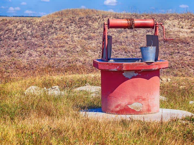
Due diligence survey of rural land with an old water well in New Braunfels, Texas

A short steel pipe poking out of tall grass doesn’t look like much. On older rural or edge-of-town land, though, it may be an old water well, and the low green patch nearby may sit over a septic field. Those features can shape where you build, how you lay out a driveway, and what permits you’ll need.

Buyers often treat old wells and septic systems as small details to sort out after closing. That’s a risky order. A due diligence survey locates what’s visible on the land before you commit, so you can judge how existing features affect your plans while you still have time to ask questions.

Why Old Wells and Septic Systems Matter During Property Due Diligence

Wells and septic systems matter because they often come with setback rules. Those rules can limit where a new home, a new septic field, or a driveway can go. An old system in the middle of a lot can cut into the best building area.

There are also cost and safety questions. An unused well may need to be properly plugged under state or local rules, and an old septic tank may need to be pumped, inspected, or removed. Knowing what’s there early helps you plan a budget and negotiate with the seller if needed.

Locating Visible Wells, Septic Components, and Other Site Features

A surveyor locates features they can see or that are marked in the field. On land with older systems, that often includes the items below.

  • Well casings, well houses, pressure tanks, and pump equipment.
  • Septic tank lids, access risers, and cleanout pipes.
  • Visible signs of a drain field, like level strips of greener grass or slight mounds.
  • Buildings, fences, driveways, power poles, and overhead lines.
  • Drainage features, culverts, and low areas that hold water.

Some parts of a septic system are buried with nothing showing at the surface. A surveyor can’t map what can’t be seen, so buried tanks and drain lines may need to be found by a septic professional first. Once those components are marked, the surveyor can tie them into the survey drawing.

Walk the property before the survey if you can. Note anything that looks like a pipe, lid, slab, or old foundation. Share those notes with the surveyor, since they help the field crew focus their search.

How Existing Utilities Affect Building Areas and Site Layout

Once features are mapped, you can see what space is left for your project. A well near the middle of the lot may push a new house toward one side. An old drain field can block the area you hoped to use for a garage or a new septic system.

Planning gets tighter on smaller lots. You may need room for a new septic field, a backup area, a driveway, and the house itself. Each of these pieces has its own spacing needs, and they all compete for the same ground.

Overhead power lines and buried utility lines add more limits. Many sit inside recorded easements that restrict building. A survey that shows both the features and the easements gives your designer a real picture of the usable area.

Reviewing Setbacks and Access Around Existing Well and Septic Locations

A setback is a required distance between two things, like a well and a septic field or a building and a property line. Setbacks for wells and septic systems are usually set by state rules and local health or permitting authorities. They can vary by county, system type, and soil conditions, so confirm the current rules for your property.

Use the survey to measure distances between the existing well, the old septic system, the property lines, and any planned improvements. This shows whether your new septic field fits, whether a neighbor’s well or septic affects your options, and whether the old well can stay in use. A neighbor’s features near the shared line can matter as much as your own.

Access matters too. Well service trucks and septic pumping trucks need a clear path to reach their equipment. Plan driveways and fences so those trucks can get in without crossing the drain field, since heavy vehicles can damage buried lines.

When Additional Records and Inspections Are Needed Before Development

A survey shows location. It doesn’t tell you whether a well produces safe water or whether a septic system works. For those answers, you’ll need other professionals and records.

Start with the seller’s disclosures and any permit records. Your county or local permitting office may have septic permits and system drawings on file. State water agencies often keep well reports that list depth and construction details, though older wells may not have records at all.

Consider these steps based on your plans:

  • A septic inspection to check the tank, lines, and drain field condition.
  • Water testing and a well inspection if you plan to use the existing well.
  • A site evaluation or soil test if you need a new septic system.
  • A topographic survey if grading or drainage will affect the building area.

Lender, title, and permit needs can vary by property type and project. If closing, financing, or construction depends on the survey or inspections, schedule them early. Inspection results sometimes lead to new questions that need time to answer.

Frequently Asked Questions

Can a surveyor find a buried septic tank?

A surveyor locates features that are visible or marked on the ground. Buried tanks and lines often have no surface signs. A septic professional can probe or use other methods to find them. Once marked, the surveyor can add them to the survey drawing.

Do I have to plug an old unused well?

Rules for abandoned or unused wells vary by state and local authority. Many places require unused wells to be properly plugged or brought back into good condition. A licensed well driller or pump installer can explain the options. Check with your local groundwater district or permitting office for current rules.

What is a due diligence survey?

A due diligence survey shows the conditions of a property before purchase. It usually includes boundaries, easements, improvements, and visible site features. The exact scope depends on the buyer, lender, and project. Ask your surveyor to include wells, septic parts, and other features you care about.

Will an old septic system stop me from building?

An old septic system doesn’t always stop a project. It may limit where you can build or require removal, repair, or replacement. Setback rules and lot size decide how much room is left. A survey plus a septic evaluation gives you a clear picture before you buy.

How early should I order a due diligence survey?

Order it as soon as you have the property under contract. That leaves time for inspections, records research, and follow-up questions. Survey schedules can vary, especially during busy seasons. If your closing date is firm, share it with the surveyor right away.

Posted in alta survey | Tagged alta survey

Land Surveying for a Shared Private Driveway

New Braunfels Land Surveying Posted on October 7, 2026 by New BraunfelsSurveyorOctober 5, 2026
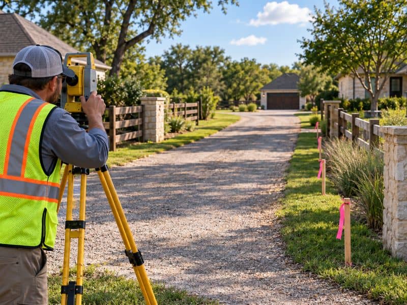
Land surveying for a shared private driveway in New Braunfels, Texas

A shared driveway can work fine for years until someone wants to repave it, sell a lot, or put up a gate. Then two questions come up fast: who owns which part, and who has the right to use it. Land surveying answers those questions with measured facts instead of memory or an old handshake deal. If you share a driveway with a neighbor, getting a survey before a project or sale can save you money, time, and stress.

Why Shared Driveways Create Surveying Questions

Most shared driveways sit on or near a property line. One owner may own the whole strip while the other has a right to cross it. In other cases, the line runs down the middle and each owner owns half. The setup often started decades ago, and the paperwork may be thin.

Trouble usually starts when something changes. A new owner moves in, a gravel lane gets paved and widened, or a fence goes up where someone thinks the line is. Each change raises the same issue, which is whether the driveway still matches the deeds and plats.

Driveways also drift over time. People pull onto the grass, add a turnaround, or widen a curve. A survey compares what’s on the ground with what’s on paper, and that comparison is where most answers come from.

Locating Property Lines Along a Shared Driveway

A boundary survey is the main tool for finding property lines along a shared driveway. The surveyor researches deeds, plats, and nearby survey records. The field crew then searches for monuments, which are iron rods, pipes, or other markers set at lot corners. The final drawing shows the lines and where the driveway sits in relation to them.

The survey often reveals one of these situations:

  • The driveway sits fully on one lot, and the neighbor crosses it.
  • The property line runs down the driveway and splits it between owners.
  • Pavement, a curb, or a parking pad extends past the area covered by access rights.
  • A fence, mailbox, or wall sits on the wrong side of the line.

If you plan work near the line, ask the surveyor to mark it on the ground. Stakes or flags make the line easy for owners and contractors to see. That small step removes a lot of guesswork.

Identifying Access and Driveway Easements

An access easement is a recorded right that lets one owner use part of another owner’s land for a set purpose, such as reaching a home. Easements usually appear in deeds, plats, or separate recorded documents. Some shared driveways also have a written maintenance agreement that explains who pays for repairs and how costs are split.

A surveyor can show recorded easements on the drawing when the documents are found in research or provided by a title company. Many surveyors work from a title commitment, which lists recorded items that affect the property. Ask whether the easement’s width and location on paper match the actual driveway. Gaps between the two are common, especially on older lots.

Some driveway rights were never written down. A surveyor can’t decide unrecorded or claimed rights, since those are legal questions. The survey can still show physical evidence, such as a worn path or pavement crossing a line, and a real estate attorney can explain what that evidence means for you.

Surveying Before Driveway Improvements or Construction

Get a survey before you repave, widen, add drainage, or build near a shared driveway. Work done in the wrong spot can land on a neighbor’s property or block someone’s access. Fixing it later often costs far more than the survey would have.

Depending on the project, a surveyor may recommend more than a boundary survey:

  • A topographic survey shows slopes and ground elevations for drainage and grading plans.
  • Construction staking marks where new edges, curbs, or culverts should go.
  • Utility locating, often done by a separate service, finds lines buried under the driveway.

Permit rules for driveway work can vary by city, county, and project scope. Some places require approval for new curb cuts, culverts, or work near a public road. Check with your local permitting office early, and order the survey first if the permit depends on it.

Using Survey Information for Property Due Diligence

Buyers should look closely at any home or lot with a shared driveway. A current survey shows where the driveway sits, which easements are recorded, and whether anything crosses a line. Lenders and title companies may ask for a survey, though their requirements vary.

Review the survey with the title commitment and any maintenance agreement. Confirm there’s a clear access route from the public road to the property. Check that the easement covers the whole driveway, and ask the seller about past disputes, repairs, or informal deals with the neighbor.

Sellers benefit too. A clean survey answers buyer questions before they turn into closing delays. It also gives both neighbors the same set of facts to work from.

Frequently Asked Questions

Do I need a survey if my shared driveway has never caused problems?

You may not need one today, but a quiet history doesn’t confirm where the lines are. Problems often show up during a sale, a repair, or a change in ownership. A survey gives you facts before that pressure arrives. It’s usually easier to sort things out when nobody is in a hurry.

What type of survey do I need for a shared driveway?

Most owners start with a boundary survey that shows property lines and recorded easements. If you’re planning grading or drainage work, a topographic survey may help. Construction staking is useful when a contractor needs exact marks in the field. Your surveyor can recommend the right scope after hearing your goals.

Can a surveyor settle a driveway dispute with my neighbor?

A surveyor can show where the lines and recorded easements fall, but can’t decide legal rights. The survey often clears up confusion on its own because both owners see the same facts. If the dispute involves unrecorded use or ownership claims, talk with a real estate attorney. The survey will still be a key piece of evidence in that conversation.

How long does a boundary survey take?

Timing depends on the property size, the records available, and the surveyor’s schedule. Simple lots with clear records move faster than older parcels with missing monuments. Research can take longer when deeds conflict or descriptions are vague. Ask for a timeline early if a closing or permit depends on it.

Will an old survey work for a shared driveway project?

An older survey can help, but it may not show recent changes like new pavement or fences. Lenders and title companies may also want a more current survey. A surveyor can review the old drawing and tell you whether an update makes sense. That review often costs less than starting from scratch.

Posted in land surveying | Tagged Land Surveying

Drone Surveying for Steep Hill Country Building Sites

New Braunfels Land Surveying Posted on September 30, 2026 by New BraunfelsSurveyorSeptember 25, 2026
Drone surveying steep Hill Country terrain near New Braunfels Texas

Drone surveying maps steep, rocky building sites fast, showing slopes, grade changes, and usable areas before home or site design begins.

From the road, a hillside lot can look like it has a perfect spot for a house. Then the architect asks for a topo map, and that flat spot turns out to be a 12-foot drop hidden behind a stand of cedar. Drone surveying helps you see the real shape of steep ground before you pay for design work that won’t fit. On rugged sites, the smartest first move is a drone survey tied to ground control, so every plan starts from accurate terrain data.

This guide is written mainly for landowners and buyers planning homes or small projects on steep, rocky lots. Builders, architects, and civil engineers will also find it useful. Each section explains what the data shows and what you should ask your surveyor before design begins.

Drone Surveying Captures Steep Terrain Before Building Design

Loose rock, ledges, and thick brush make traditional fieldwork slow and costly. A drone can cover those areas in a single flight and record the ground in consistent detail.

There are limits you should know up front. Photo-based mapping can’t see the ground under dense tree cover, and LiDAR only captures ground where laser pulses slip through gaps in the canopy. Heavily wooded pockets may still need a crew on foot.

Aerial Data Reveals Grade Changes Across Difficult Building Sites

Grade change is the difference in elevation from one point to another. On steep sites, that change can be sharp and uneven, with sudden drops, benches, and rock shelves. A drone survey shows these shifts across the whole lot instead of at a few spot checks.

The contour map is the most useful piece for most owners. Contour lines connect points of equal elevation, so lines packed close together mean steep ground. Lines spaced farther apart show gentler areas where building is usually easier.

Ask your surveyor what contour interval they’ll provide. A one-foot or two-foot interval is common for building sites, but the right choice depends on the project and your designer’s needs. Settle this before the flight so the files match what the design team expects.

Mapping Slopes Helps Identify Practical Building Areas

Slope is how steep the ground is, often shown as a percent. A 10 percent slope rises 10 feet over 100 feet of distance. A slope map colors the site by steepness, so you can spot the practical building areas at a glance.

What to Look For on a Slope Map

Look for broad, gentle zones that can hold the house, garage, and yard without huge retaining walls. Watch for narrow benches that look flat on the map but drop off sharply on every side. Those spots can work, but foundation and wall costs often climb fast.

Planning for Septic and Drainage

Many rural hillside lots rely on septic systems. These often need suitable soil and slope in a specific area, and rules vary by county and permitting authority. Check with the local permitting office and a soil professional early, since the septic area can limit where the house goes.

Drainage also shows up clearly on the terrain model. Water moves downhill fast on steep ground and can erode driveways and pads. Your engineer can use the model to plan swales, culverts, and grading that carry water safely around the building area.

Drone Survey Data Supports Access and Site Planning

Getting to the house site is often harder than building on it. A driveway that climbs too steeply can be tough for cars, delivery trucks, and fire equipment. Local rules may set limits on driveway grade or fire access, and those rules vary by city and county.

The terrain model lets designers test several driveway routes before choosing one. A route that winds a little longer may cut grading costs and keep the grade manageable. That kind of comparison is hard to do well without good elevation data.

Site planning goes beyond the drive. Designers can use the same data to place utility runs, a well site if needed, parking, and outdoor spaces. The aerial image also helps everyone see trees and rock features worth keeping.

Combining Drone Mapping With Ground Survey Control

A drone map is only as good as its ties to the ground. Ground control points are marked targets that a surveyor measures with GPS or other precise equipment. The drone data is then locked to those positions, which keeps the model accurate in both location and elevation.

Good surveyors also set checkpoints. These are measured points kept out of the model so they can test it afterward. If the model matches them within the stated tolerance, you can trust it for design.

On steep sites, ground work fills other gaps too. Crews may measure dense tree areas, rock ledges, and key features that the drone can’t see well. A boundary survey is still needed to locate legal property lines, since a drone can’t set boundaries. Survey needs vary by lender, county, and project scope, so confirm requirements early when permitting or construction depends on them.

Frequently Asked Questions

Is drone surveying accurate enough for building design?

It can be, when it’s tied to measured ground control and checked against independent points. Accuracy depends on the equipment, flight height, tree cover, and terrain. Open areas usually map more accurately than brushy or wooded ones. Ask your surveyor what accuracy to expect and how they’ll prove it before design starts.

Can a drone see through trees on a hillside lot?

Photo-based drone mapping can’t see the ground under thick canopy. LiDAR can capture some ground points through openings in the trees. Dense cedar or oak stands may still need ground survey work to fill gaps. Your surveyor can recommend the right mix based on your lot’s cover.

Does a drone survey replace a topographic survey?

A drone survey is one way to create topographic data. With proper ground control, the drone model can become the base for a topographic map. Some features, like utilities or hidden areas under trees, may still need ground measurements. Many projects use both methods together for the best result.

Posted in Drone LiDAR Mapping | Tagged Drone LiDAR Mapping

Post navigation

← Older posts
Get Quote Button
© Boxer Survey USA
New Braunfels Land Surveying

New Braunfels, Texas
Phone: (830) 243-6700

Web Development and SEO by:
AuburnBusiness.com, LLC


Privacy Policy | Terms of Use

The owner of this website, Boxer Survey USA, provides coordination of professional land surveying and engineering services in all 50 states. The professional surveying and engineering services provided to you will be conducted by fully licensed professionals in your state.

Privacy Policy
↑