
↓
 

New Braunfels Land Surveying

Local Land Surveyors in New Braunfels, TX

New Braunfels Land Surveying
  • Home
  • ALTA Survey
  • Boundary Surveying
  • Construction Survey
  • Elevation Certificate
  • Drone LiDAR Mapping
  • Land Surveying
  • Topographic Survey
  • Blog
  • Contact Us
Home - Page 2 << 1 2 3 4 … 13 14 >>

Post navigation

← Older posts
Newer posts →

Land Survey for a New Access Road Across Large Property

New Braunfels Land Surveying Posted on October 28, 2026 by New BraunfelsSurveyorOctober 27, 2026
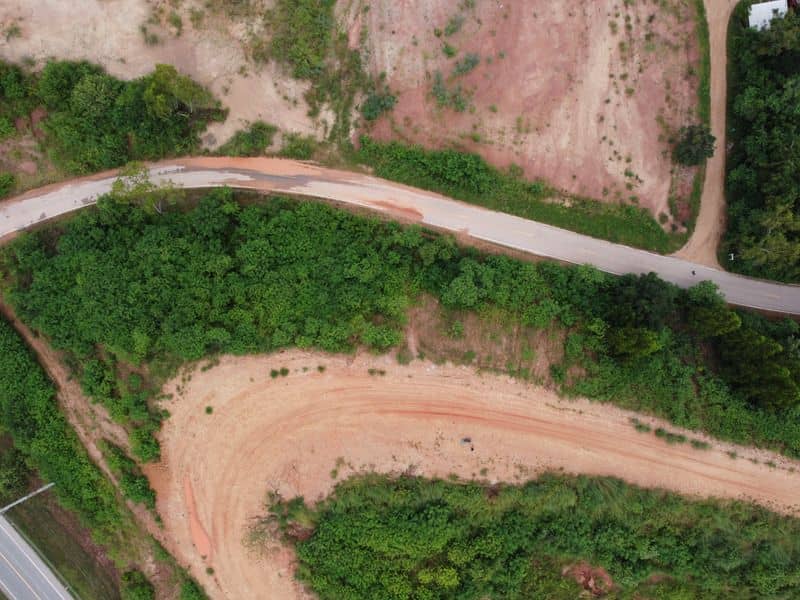
Aerial view of a winding dirt access road across undeveloped land, illustrating how a land survey supports road alignment and construction planning in New Braunfels, Texas.

A road built in the wrong place is hard to move. Once the gravel is down and the culverts are set, fixing a bad route means tearing out work you already paid for. On large acreage, the wrong route can also run into a creek, a steep slope, or a neighbor’s fence line.

A land survey helps you pick a route that works the first time. It shows the boundaries, the terrain, and the legal access rules that shape where a road can go. This guide is for landowners, ranch buyers, and developers, and it covers each survey step from route choice to construction layout.

Evaluating Possible Access Road Routes Across Large Acreage

The best road route balances distance, cost, and long-term use. A shorter route can cost more if it crosses wet ground or steep hills. Land surveying provides the boundary and terrain information needed to compare possible access road routes before any clearing begins. 

Start by deciding what the road needs to handle. A road for one home has different needs than one for livestock trailers, farm equipment, or future lots. Tell your surveyor how you plan to use the land over the next ten or twenty years.

Also note where the road must connect. Most access roads tie into a public road at one end and a homesite, barn, or gate at the other. For properties where the route connects to or serves a neighboring property, shared driveway arrangements can raise questions about access rights, property boundaries, and maintenance responsibilities. .

How Land Surveying Identifies Terrain and Natural Obstacles

A topographic survey maps the shape of the ground. It shows elevations, slopes, low spots, and drainage paths across the property. On very large tracts, drone or LiDAR data can speed up mapping before field crews check key areas.

Large properties often hide problems you can’t see from the gate. Some only show up after a heavy rain. A topographic survey can locate features such as:

  • Creeks, draws, and low-water crossings
  • Steep slopes, rock outcrops, and wet areas
  • Fences, gates, ponds, and existing ranch trails
  • Visible utilities such as power poles and pipeline markers

Drainage needs extra care. A road that crosses a draw or creek may need culverts, and work in a mapped floodplain can trigger extra permits. Ask your surveyor or engineer to flag floodplain areas early so they don’t reshape the route late in the process.

Establishing Road Alignment, Width, and Property Boundary Clearances

Alignment is the path the road’s centerline follows across the land. Once a route is chosen, the surveyor sets the alignment with curves, straight runs, and grades that vehicles can handle safely. Road width depends on how the road will be used, plus room for shoulders and ditches.

Property boundaries also influence road placement. Land survey helps establish accurate property lines so the proposed access road stays within the intended boundaries.  Old fences on large tracts often sit off the true line, sometimes by many feet.

Keep the road a safe distance from the property line. Some counties, subdivisions, or deed restrictions set minimum setbacks, while others don’t. Confirm the rules that apply before the design is final, because moving a road later costs far more than moving a line on paper.

Documenting Access Road Easements and Right-of-Way Requirements

An access easement gives someone the legal right to cross land owned by someone else. If your new road crosses a neighbor’s property or will serve other tracts, you’ll usually need one. The land survey creates the drawing and legal description that define where the easement sits.

A right-of-way is a strip of land set aside for a road or utility. It may belong to a public entity or be held as an easement, depending on how it was created. Existing rights-of-way for pipelines, power lines, or public roads can limit where your new road crosses.

Review your deed records and title documents for existing easements before choosing a route. A surveyor can show those easements on the map so conflicts appear early. Have an attorney or title company review any new easement language, since these documents carry legal weight.

Preparing Survey Data for Road Design and Construction Layout

Once the route, width, and easements are set, the survey data goes to the road designer or civil engineer. They use it to plan grades, ditches, culverts, and the road base. Accurate land survey information helps engineers plan road grades, drainage features, and construction layouts while reducing unexpected site conditions. 

Construction staking comes next. The surveyor places stakes along the route to mark the centerline, edges, and grades for the contractor. Some stakes show cut and fill, which tells crews how much soil to remove or add.

Plan for a few return visits. Stakes get knocked out, and long roads are often built in phases. An as-built survey after completion records where the road was actually built, which helps with future easement or sale paperwork.

Frequently Asked Questions

Is a land survey required before building an access road on private property?

Rules vary by county, project type, and whether the road connects to a public roadway. Some projects need a survey for permits, financing, or easements, while others may not. Even when one isn’t required, a land survey helps you avoid building on a neighbor’s land or in a poor spot. Check with your county and any lender early to confirm what’s needed.

How does a land surveyor determine the best route for a new access road?

A land surveyor starts by mapping boundaries, terrain, and existing features. They then compare possible routes based on slope, drainage, distance, and connection points. Easements and existing rights-of-way also shape the choice. The surveyor often works with an engineer to confirm the route can be built safely and at a fair cost.

Can a topographic survey help identify suitable road locations across large acreage?

Yes, a topographic survey is one of the most useful tools for road planning. It shows elevations, slopes, and drainage paths across the whole property. That makes it easier to avoid steep grades, wet ground, and costly creek crossings. On large tracts, drone or LiDAR data can help map the land faster.

What is the difference between an access easement and a right-of-way?

An access easement gives someone a legal right to cross another person’s land. A right-of-way is a strip of land set aside for a road, utility, or similar use. The terms overlap, and a right-of-way is often held as a type of easement. The exact meaning depends on how the document was written, so have a title company or attorney review it.

When should construction staking begin for a new access road?

Construction staking should begin after the road design is approved and any needed permits are in hand. Stakes placed too early may be lost before the contractor arrives. Most surveyors stake just ahead of clearing and grading, then return for later phases. Coordinate the schedule with your contractor so crews have marks when they need them.

Posted in land surveying | Tagged Land Surveying

Perc Test and Survey Planning for a Rural Homesite

New Braunfels Land Surveying Posted on October 21, 2026 by New BraunfelsSurveyorOctober 16, 2026
Soil samples being collected for soil evaluation and perc test planning on a rural homesite in New Braunfels, Texas.

Rural land listings love the phrase “ready to build.” Many buyers learn later that a homesite without city sewer isn’t ready for anything until the soil passes a septic review. A failed or poorly placed test can force a redesign, add thousands to the septic budget, or shrink the usable part of the land.

Planning the perc test and the land survey together gives you a much better shot at a smooth approval. The survey shows boundaries, slopes, drainage paths, and features that limit where a septic system can go. Testing in the right spot the first time saves money, time, and frustration for buyers, builders, and owners alike.

Evaluating Soil Conditions Before Scheduling a Perc Test

A perc test measures how quickly water soaks into the soil. Some states and counties use a broader soil evaluation instead, where a licensed evaluator digs test pits and checks soil type, depth to rock, and signs of seasonal water. Either way, the goal is to show whether the ground can safely treat wastewater from a septic system.

Do some homework before the evaluator arrives. Look at public soil maps, walk the land after rain, and note areas with standing water, exposed rock, or steep slopes. Those clues help you and the evaluator focus on the most promising ground.

Ask your septic designer or evaluator which test method applies to your property. Rules vary by state, county, and local permitting authority. Knowing the process early helps you plan site visits and budget for any follow-up work.

Using Land Survey Data to Identify Suitable Septic System Areas

A septic system needs space, and that space must meet distance rules. Most permitting authorities require minimum separations from property lines, wells, creeks, drainage ways, buildings, and easements. A land survey shows where those features sit so the designer can find areas that comply.

Topographic data adds another layer. Septic drain fields usually work best on gentle slopes, and very flat or very steep ground can cause problems. A topographic survey shows slope direction and low spots that may collect runoff or stay wet.

Combining the boundary survey and topo gives a clear map of usable septic areas. That map should guide where the soil tests happen. Testing outside a usable area wastes money because the result can’t support the final design.

Coordinating Perc Test Locations With Proposed Home and Well Placement

The house, the well, and the septic system all compete for space on a rural lot. Wells usually need to stay a set distance away from septic tanks and drain fields. The house needs room for a driveway, a yard, and future improvements like a shop or pool.

Sketch a rough layout before the soil test is scheduled. Mark where you’d like the home, the well, the driveway, and the septic field, then check them against the survey. The surveyor or designer can help confirm whether required separations are possible.

Plan for a backup drain field area if the rules allow or require it. Some authorities ask owners to set aside a reserve area in case the first field fails. Saving that space now prevents problems if repairs are ever needed.

Addressing Limestone Terrain and Drainage Constraints on Rural Homesites

Shallow rock is one of the most common challenges for rural septic systems. Limestone close to the surface leaves little soil to filter wastewater before it reaches rock or groundwater. Evaluators often find that rocky sites need special system designs.

Drainage adds more limits. Water running across a hillside or through a dry creek bed can flood a drain field after heavy rain. A survey shows where those flow paths run so the septic area can stay out of them.

These conditions don’t always rule out a homesite. Engineered systems, such as aerobic treatment units or drip distribution, may work where a standard system won’t. Costs and maintenance can be higher, so factor them in before you close on the land.

Preparing Survey and Perc Test Results for Septic Permits

Most septic permit applications require a site plan along with the soil evaluation and system design. The site plan shows property lines, the house, the well, the septic components, and required separation distances. A survey-based plan helps reviewers confirm those distances quickly.

Requirements vary by county, local permitting authority, and system type. Some offices want specific scales, labels, or certifications on the drawing. Confirm the checklist before the designer prepares the plan so you don’t resubmit.

Keep copies of everything once the permit is approved. The survey, soil report, and approved design help with construction, inspections, and future sales. They also make repairs easier if the system ever needs work.

Frequently Asked Questions

Is a perc test required before building a rural home in New Braunfels?

Rural homes without sewer service generally need an approved septic permit, and that process usually includes a soil evaluation. The local permitting authority for on-site sewage systems sets the exact steps. Some offices call it a soil evaluation instead of a perc test. Confirm the requirements with the county or local authority before buying or designing.

How does a land survey help determine where a septic system can go?

The survey shows property lines, easements, wells, creeks, buildings, and slopes. Septic rules often require minimum distances from many of those features. With that map, the designer can find areas that meet separation rules. The soil test can then be placed where a system could actually be built.

Can a perc test fail because of rocky or limestone soil?

Yes, shallow rock is a common reason for poor results. Limestone close to the surface leaves too little soil to treat wastewater properly. That doesn’t always mean the land can’t have a septic system. It may need an engineered design that costs more to install and maintain.

Should a property survey be completed before scheduling a perc test?

In most cases, yes. A survey shows where the property lines and required setbacks are, so the test happens in a usable spot. Testing without that information can lead to results that don’t fit the final layout. Ordering the survey first often saves time and repeat testing.

What happens if a rural homesite does not pass a perc test?

A failed test doesn’t always end the project. The evaluator may test another area, or the designer may recommend an alternative system. Options like aerobic treatment units or drip distribution may be allowed, depending on local rules. Talk with your designer about costs and maintenance before moving forward.

Posted in land surveying | Tagged Land Surveying

Due Diligence Survey for Land With an Old Well or Septic

New Braunfels Land Surveying Posted on October 14, 2026 by New BraunfelsSurveyorOctober 12, 2026
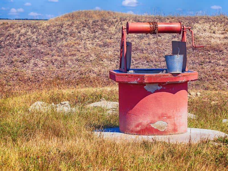
Due diligence survey of rural land with an old water well in New Braunfels, Texas

A short steel pipe poking out of tall grass doesn’t look like much. On older rural or edge-of-town land, though, it may be an old water well, and the low green patch nearby may sit over a septic field. Those features can shape where you build, how you lay out a driveway, and what permits you’ll need.

Buyers often treat old wells and septic systems as small details to sort out after closing. That’s a risky order. A due diligence survey locates what’s visible on the land before you commit, so you can judge how existing features affect your plans while you still have time to ask questions.

Why Old Wells and Septic Systems Matter During Property Due Diligence

Wells and septic systems matter because they often come with setback rules. Those rules can limit where a new home, a new septic field, or a driveway can go. An old system in the middle of a lot can cut into the best building area.

There are also cost and safety questions. An unused well may need to be properly plugged under state or local rules, and an old septic tank may need to be pumped, inspected, or removed. Knowing what’s there early helps you plan a budget and negotiate with the seller if needed.

Locating Visible Wells, Septic Components, and Other Site Features

A surveyor locates features they can see or that are marked in the field. On land with older systems, that often includes the items below.

  • Well casings, well houses, pressure tanks, and pump equipment.
  • Septic tank lids, access risers, and cleanout pipes.
  • Visible signs of a drain field, like level strips of greener grass or slight mounds.
  • Buildings, fences, driveways, power poles, and overhead lines.
  • Drainage features, culverts, and low areas that hold water.

Some parts of a septic system are buried with nothing showing at the surface. A surveyor can’t map what can’t be seen, so buried tanks and drain lines may need to be found by a septic professional first. Once those components are marked, the surveyor can tie them into the survey drawing.

Walk the property before the survey if you can. Note anything that looks like a pipe, lid, slab, or old foundation. Share those notes with the surveyor, since they help the field crew focus their search.

How Existing Utilities Affect Building Areas and Site Layout

Once features are mapped, you can see what space is left for your project. A well near the middle of the lot may push a new house toward one side. An old drain field can block the area you hoped to use for a garage or a new septic system.

Planning gets tighter on smaller lots. You may need room for a new septic field, a backup area, a driveway, and the house itself. Each of these pieces has its own spacing needs, and they all compete for the same ground.

Overhead power lines and buried utility lines add more limits. Many sit inside recorded easements that restrict building. A survey that shows both the features and the easements gives your designer a real picture of the usable area.

Reviewing Setbacks and Access Around Existing Well and Septic Locations

A setback is a required distance between two things, like a well and a septic field or a building and a property line. Setbacks for wells and septic systems are usually set by state rules and local health or permitting authorities. They can vary by county, system type, and soil conditions, so confirm the current rules for your property.

Use the survey to measure distances between the existing well, the old septic system, the property lines, and any planned improvements. This shows whether your new septic field fits, whether a neighbor’s well or septic affects your options, and whether the old well can stay in use. A neighbor’s features near the shared line can matter as much as your own.

Access matters too. Well service trucks and septic pumping trucks need a clear path to reach their equipment. Plan driveways and fences so those trucks can get in without crossing the drain field, since heavy vehicles can damage buried lines.

When Additional Records and Inspections Are Needed Before Development

A survey shows location. It doesn’t tell you whether a well produces safe water or whether a septic system works. For those answers, you’ll need other professionals and records.

Start with the seller’s disclosures and any permit records. Your county or local permitting office may have septic permits and system drawings on file. State water agencies often keep well reports that list depth and construction details, though older wells may not have records at all.

Consider these steps based on your plans:

  • A septic inspection to check the tank, lines, and drain field condition.
  • Water testing and a well inspection if you plan to use the existing well.
  • A site evaluation or soil test if you need a new septic system.
  • A topographic survey if grading or drainage will affect the building area.

Lender, title, and permit needs can vary by property type and project. If closing, financing, or construction depends on the survey or inspections, schedule them early. Inspection results sometimes lead to new questions that need time to answer.

Frequently Asked Questions

Can a surveyor find a buried septic tank?

A surveyor locates features that are visible or marked on the ground. Buried tanks and lines often have no surface signs. A septic professional can probe or use other methods to find them. Once marked, the surveyor can add them to the survey drawing.

Do I have to plug an old unused well?

Rules for abandoned or unused wells vary by state and local authority. Many places require unused wells to be properly plugged or brought back into good condition. A licensed well driller or pump installer can explain the options. Check with your local groundwater district or permitting office for current rules.

What is a due diligence survey?

A due diligence survey shows the conditions of a property before purchase. It usually includes boundaries, easements, improvements, and visible site features. The exact scope depends on the buyer, lender, and project. Ask your surveyor to include wells, septic parts, and other features you care about.

Will an old septic system stop me from building?

An old septic system doesn’t always stop a project. It may limit where you can build or require removal, repair, or replacement. Setback rules and lot size decide how much room is left. A survey plus a septic evaluation gives you a clear picture before you buy.

How early should I order a due diligence survey?

Order it as soon as you have the property under contract. That leaves time for inspections, records research, and follow-up questions. Survey schedules can vary, especially during busy seasons. If your closing date is firm, share it with the surveyor right away.

Posted in alta survey | Tagged alta survey

Post navigation

← Older posts
Newer posts →
Get Quote Button
© Boxer Survey USA
New Braunfels Land Surveying

New Braunfels, Texas
Phone: (830) 243-6700

Web Development and SEO by:
AuburnBusiness.com, LLC


Privacy Policy | Terms of Use

The owner of this website, Boxer Survey USA, provides coordination of professional land surveying and engineering services in all 50 states. The professional surveying and engineering services provided to you will be conducted by fully licensed professionals in your state.

Privacy Policy
↑